EN
Translate:
EN
Signed in as:
filler@godaddy.com

Analysis shows Annual Water Level Measurements (Jan 2024) taken by Big Bend GMD 5, Division of Water Resources, and the Kansas Geological Survey.
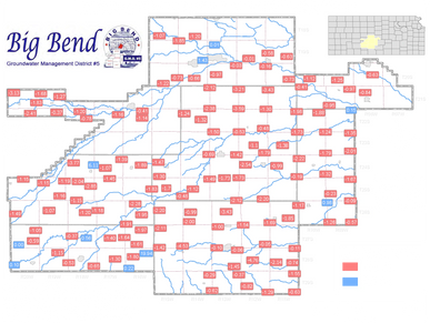
Analysis compares Annual Water Level Measurements (Jan 2023 - Jan 2024) taken by Big Bend GMD 5, Division of Water Resources, and the Kansas Geological Survey.
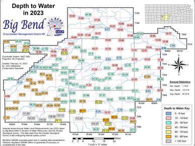
Analysis shows Annual Water Level Measurements (Jan 2023) taken by Big Bend GMD 5, Division of Water Resources, and the Kansas Geological Survey.
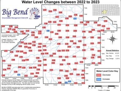
Analysis compares Annual Water Level Measurements (Jan 2022 - Jan 2023) taken by Big Bend GMD 5, Division of Water Resources, and the Kansas Geological Survey.
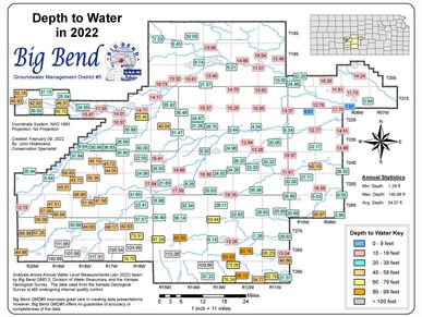
Analysis shows Annual Water Level Measurements (Jan 2022) taken by Big Bend GMD 5, Division of Water Resources, and the Kansas Geological Survey.
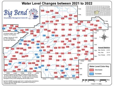
Analysis compares Annual Water Level Measurements (Jan 2021 - Jan 2022) taken by Big Bend GMD 5, Division of Water Resources, and the Kansas Geological Survey.
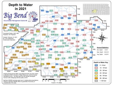
Analysis shows Annual Water Level Measurements (Jan 2021) taken by Big Bend GMD 5, Division of Water Resources, and the Kansas Geological Survey.
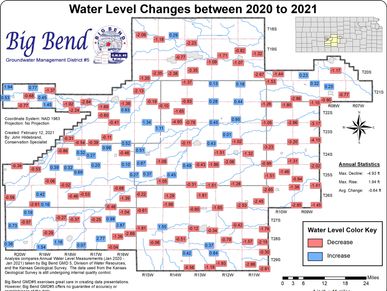
Analysis compares Annual Water Level Measurements (Jan 2020 - Jan 2021) taken by Big Bend GMD 5, Division of Water Resources, and the Kansas Geological Survey.

Analysis shows Annual Water Level Measurements (Jan 2020) taken by Big Bend GMD 5, Division of Water Resources, and the Kansas Geological Survey.
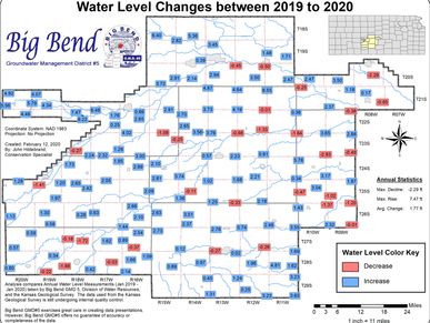
Analysis compares Annual Water Level Measurements (Jan 2019 - Jan 2020) taken by Big Bend GMD 5, Division of Water Resources, and the Kansas Geological Survey.